|
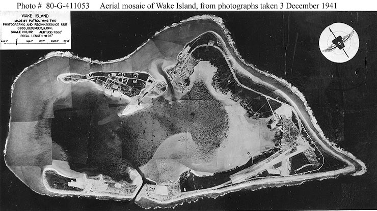
Photo #: 80-G-411053 Wake Island Overall mosaic prepared by the Photographic and Reconnaissance Unit, Patrol Wing Two, from vertical aerial photographs taken at 0900 on 3 December 1941. The view is oriented on a NW-SW line, with the northeastern point of Wake at the top. Wake Island is at right, with Peale Island in the upper left and Wilkes Island in the lower left. Official U.S. Navy Photograph, now in the collections of the National Archives. Online Image: 94KB; 740 x 415 pixels Reproductions of this image may also be available through the National Archives photographic reproduction system. |
 |
Click on the small photograph to prompt a larger view of the same image.
If you want higher resolution reproductions than this digital image, see: "How to Obtain Photographic Reproductions."
5 January 2001